")
SASSO S.MARTINO A GRIANTE CADENABBIA
Splendid walk that leeds up to Sasso S. Martino from where the wonderful view faces all directions.
Starting point of the walk : Parking lot at Rogaro 2 km above Tremezzo (5 km from Lenno Dolcelago).
ITINERARY: Parcheggio di Rogaro - Monti di Pilone Sasso S. Martino - Monti di Pilone - Monti di Nava - Parcheggio di Rogaro
Duration of the walk: 4.00 hr
ASCENT: 540 m.
DIFFICULTY: A walk for trained hikers – some small landslips are between Pilone and Monti di Nava.
Good hiking boots are recommended.
Car route from Tremezzo to the parking lot of Rogaro: At Tremezzo, near the park Olivelli, you pick up via Peduzzi which turns into via Ugo Ricci. After 300 m turn right in the direction of Rogaro. Past the restaurant Rusall, continue another 400 m in order to reach the parking lot on the left with a picnic area.
For those who wish to reach the parking lot by foot, it takes 0h30 with an ascent of 160 m.
Route by foot: From the parking lot at Rogaro proceed another 100 m on the paved road and then pick up the cart track to the left to S. Martino (sign).
At intersection, just past a small olive grove, continue straight on. On the right you will notice an area used by the wildlife rangers as recovery for deer that have been either wounded or rejected by their mother.
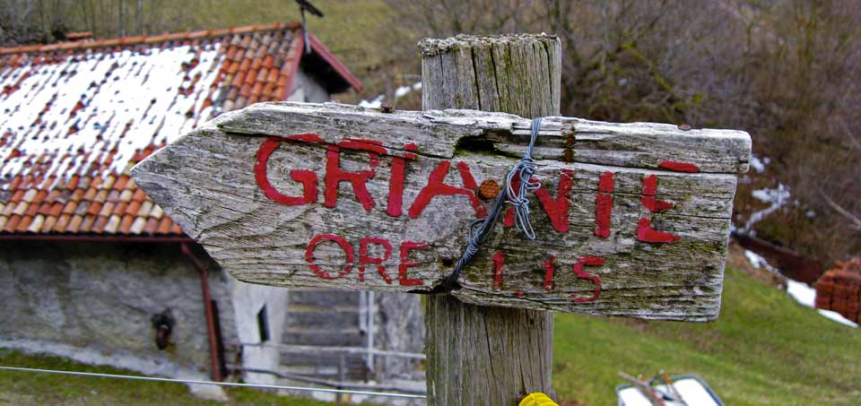
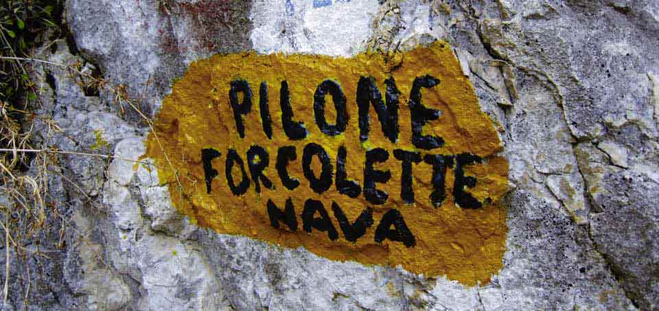
You descend into a small valley and then ascend its opposite side either over the steep trail or along the steep steps. The trail then follows a more relaxing stretch with a great view of Bellagio. A steep flight of steps brings you to the degrading fields of the Monte Crocione while advancing towards the impressing rocky face of Sasso S. Martino. Attention: just past the ruins of a farmstead and at the beginning of a guard rail, turn left for Pilone - Forcolette (painted sign on the rock).
You will be leaving the trail that leads to the church of S. Martino.
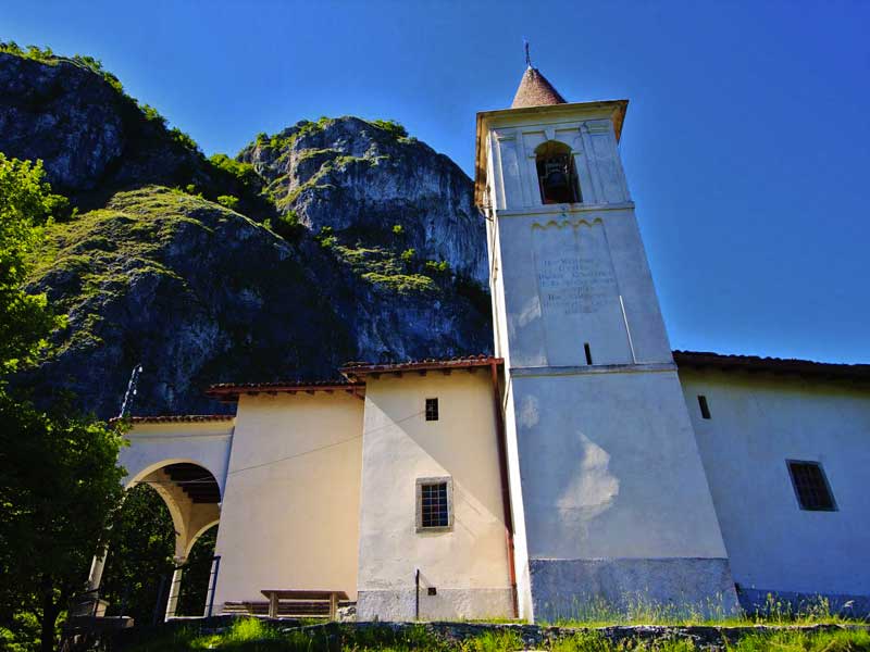
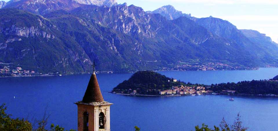
The trail ascends in small bends among the steep fields with a breathtaking view of the plain of Rogaro, Griante and the church of S. Martino.
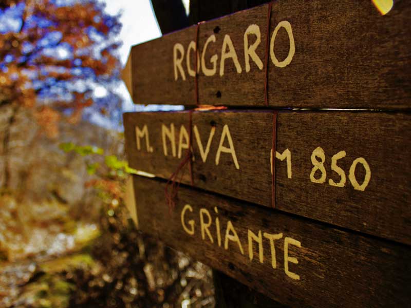
The path enters a deep narrow section that offers suggestive views between the rocks of the lake. You then arrive at the buildings of Monte Pilone, 800 m and 1h30 from the parking lot at Rogaro. You abandon the path that continues to Monti di Nava in order to reach Sasso San Martino. You head towards the picnic table and walk between the buildings. After 150 m there is an intersection where you take to the right for Sasso S. Martino.
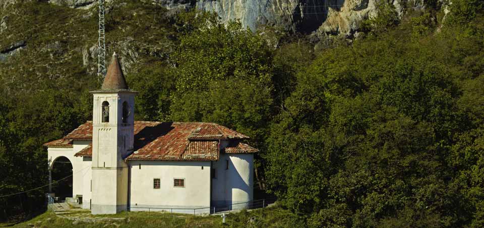
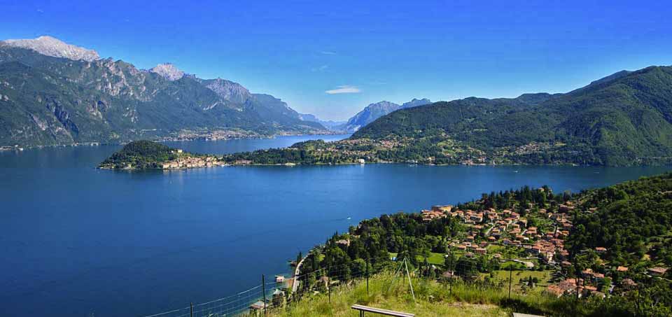
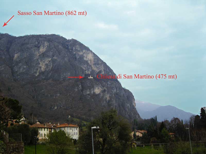
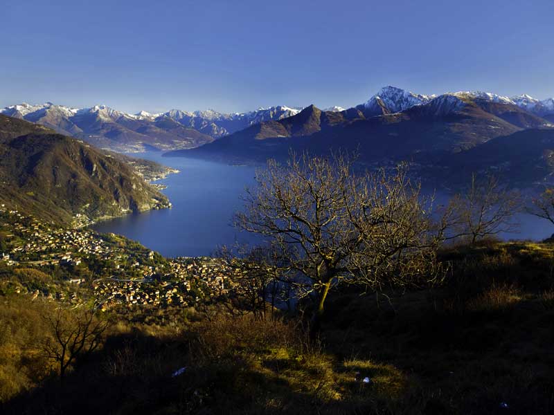
In the beginning the path winds up in bends on the northern part of the hill before turning to the southern face. After an accent of about 10 minutes the trail descends to a wide grassy basin. From here the trail leads to the most outer point of Sasso S. Martino, 818 m and 2h00 from departure. The view faces all directions: the Centre Lake area with the Grigne mountains on the background, and the whole northern end of the lake with Menaggio in the foreground. This area was part of the great defence line called “Linea Cadorna”, built in 1915 along the Swiss-Italian border, to block a possible German offence. In the province of Como it extended from Monte Bisbino near Como to Sasso Gordona, Monte Galbiga and Monte Crocione and from there down to Sasso S. Martino and the Crocetta. In fact you can notice trenches and defence posts. After you have enjoyed the view, return on your previous path to Monte Pilone. Here you pick up the trail that ascends to Monti di Nava.
The path winds up in bends and comes into an area of landslips where you must pay attention. The ascent finishes right in front of a large grassy trail situated between two slopes. Follow this, first flat, then downhill trail across the Dossone to Monti di Nava, 885m and 3h from the departure. The trail ends on a cart track near a small shrine. Turn left. This cart track is part of the Via dei Monti Lariani path 2, a trekking tour of 125 km which connects the mountain settlements on the west side of the lake. After 400 m at the height of the last houses of Monti di Nava (sign Griante), you leave the Via dei Monti Lariani and pick up the trail paved with cement which passes along the last houses of Monti di Nava. The track leads down in wide bends with a most beautiful view of the peninsula of Lavedo, and the towns of Tremezzo, Mezzegra and Lenno. It then turns to the slope above Griante with a splendid view of Sasso S. Martino and the little church. You pass the deviation for the “Cappella degli Alpini” (reachable in 10 minutes) and shortly after you arrive at a fork, where you keep left. You again reach the plain of Rogaro and end on the paved road right next to the parking lot of Rogaro.
Thanks to www.lakecomo.it